Location and Access
The 100% owned PEN gold property (“PEN”), (4637 ha), is centered at approximately 49º 44’ 22’’ N Latitude; 86º 48’ 04’’ W Longitude (UTM Coordinates 514312E; 5509703N (Zone 16N NAD83 Datum).
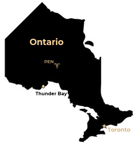
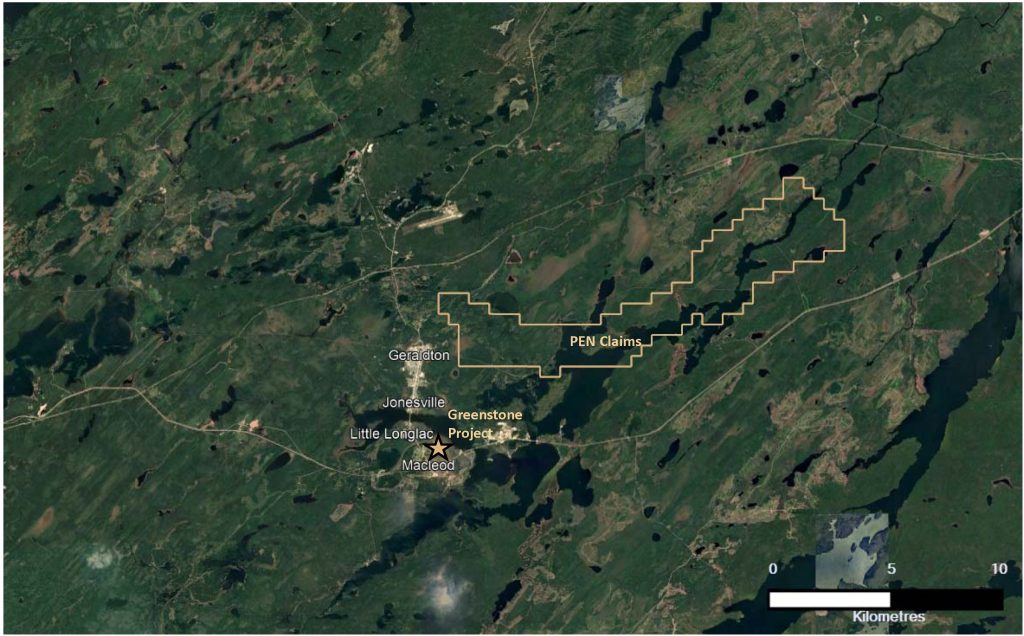
PEN is located approximately 275 km northeast of Thunder Bay, Ontario and less than a kilometre east of Geraldton. Access is via paved provincial highway # 11.
PEN is a greenfield exploration opportunity located 4-kms North of Equinox’s Greenstone Project, currently under development as a large tonnage, low grade open pit mine.
Regional and Local Geology
The PEN property is in the Archean Superior Province, Wabigoon Subprovince, in the east-west trending Beardmore-Geraldton Greenstone Belt (“BGGB”). The BGGB consists of three, fault bounded, steep north dipping series, each containing metasedimentary rocks uncomformably overlying metavolcanic rocks. From north to south, the metasedimentary rocks are believed to have originated from the Wabigoon in the north and developed as alluvial fan, submarine fan and deep water turbidites. The mafic to intermediate metavolcanic rocks comprise three units identified as the Northern, Central and Southern Volcanic Units (“NVU”, “CVU” and “SVU”). Each unit consists of varying proportions of massive lava flows, pillowed lava flows and mafic intrusions. PEN is situated within the CVU.
Mineralogy of the BGGB consists of greenschist facies assemblage with various amounts of chlorite, epidote, albite, tremolite and actinolite, with or without quartz and calcite.
Mineralization
Gold was discovered in the area in the 1880’s and over 4.0 million ounces of gold have been produced from various mines, most of which were hosted in the sedimentary rocks between the SVU and CVU. Gold mineralization occurs primarily in quartz veins that parallel major shear structure and occupy axial planar cleavage planes of pre-existing fold structures. Quartz vein stockwork, pyrite and arsenopyrite accompany nearly all the known deposits in the belt.
History
Given PEN’s close proximity to the Geraldton mines, it is likely that the PEN property was prospected in the 1930’s at the peak of historical mining activity in the region. Historical records indicate Little Long Lac Gold Mines drilled five (5) holes in the late 1940’s but no results are on record. Several old trenches are noted in the government maps of the region but no results are reported.
In 1996, Peninsula Gold Mines Ltd. (“Peninsula”) completed VLF EM and magnetometer surveys that identified several conductors. Peninsula also completed soil geochemical sampling over the south-central portion of the claims that returned values ranging from 50 ppb to 334 ppb gold.
In 1998, Peninsula completed trenches at multiple locations with the best results returned from a 6.0-metre wide pyrite-arsenopyrite quartz stockwork zone along the northern shore of Lake Kenogamisis, which returned 5.45 g/t gold from a grab sample and multiple results greater than 1.00 g/t gold over sub-metre channel samples collected across the 6.0 metre mineralized zone as well as from other trenches elsewhere on the claims.
Seven (7) drill holes were completed to follow up on the encouraging trench values but in general, results were limited to sub-gram gold grades over sum-metre intervals. The best drill hole was the final hole completed, P-7, where historical records indicated an intersection of 3.33 g/t Au over 2.6 metres with a note that the intersection was surrounded by lower tenor gold mineralization for over 20.0 metres.